Current conditions
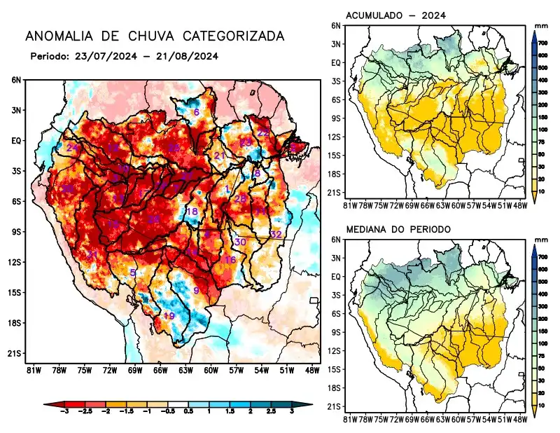
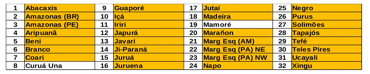
Maps of observed precipitation conditions, individual graphics by basin are produced from MERGE/GPM data generated by INPE/CPTEC, considering the period from de 2000 a 2023. Between July 23 and August 21, 2024, the rainfall pattern remains below climatological levels in a large part of the monitored area, with a precipitation deficit along the course of the Amazon in Peruvian and Brazilian territory, the basins of the Abacaxis, Aripuanã, Beni, Branco, Coari, Guaporé, Içá, Iriri rivers, Japurá, Javari, Ji-Paraná, Juruá, Juruena, Jutaí, Madeira, Marañon, basins on the left bank of the Amazon River in the northeast of the state of Amazonas and the northeast and northwest of the state of Pará, Napo, Negro, Purus, Tapajós, Tefé, Teles Pires, Ucayali, Xingu and the main course of the Solimões River. The Branco and Mamoré river basins alternated areas with positive and negative anomalies, and were considered to have precipitation close to the climatology for the period. The multimodel sub-seasonal forecast indicates rainfall below climatology predominating over the central region, such as the basins on the right bank of the Amazon River (Abacaxis, Aripuanã, Iriri, Javari, Jutaí, Madeira, Tapajós, Tefé) and the northeast, at the mouth of the Amazon River near Marajó Island (PA).