Current conditions
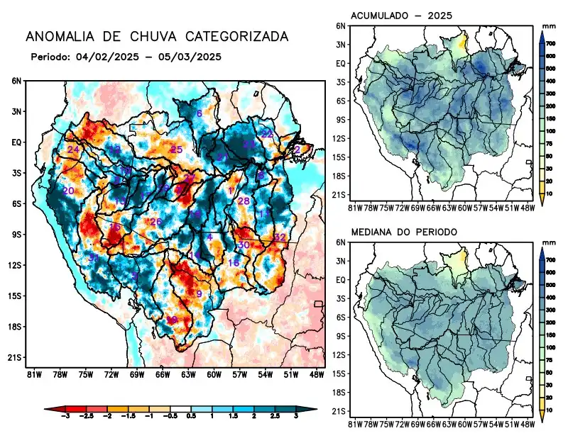
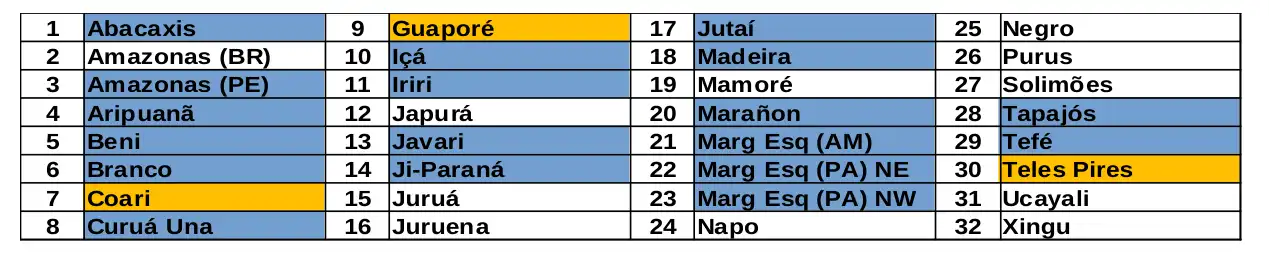
Maps of observed precipitation conditions, individual graphics by basin are produced from MERGE/GPM data generated by INPE/CPTEC, considering the period from de 2000 a 2024. Between December 31 and January 29, 2025, rainfall below climatology in the monitored area characterized the Coari, Guaporé and Teles Pires river basins with a precipitation deficit, while rainfall above climatology characterized the main course of the Amazon River in Peruvian territory, the basins of the Abacaxis, Aripuanã, Beni, Branco, Curuá Una, Içá, Iriri, Javari, Ji-Paraná, Jutaí, Madeira, Marañon rivers, the basins on the left bank of the Amazon River in the northeast of the state of Amazonas and the northeast and northwest of the state of Pará, Tapajós and Tefé. Rainfall behavior close to climatology over the main course of the Amazon River in Brazilian territory, the basins of the Japurá, Juruá, Juruena, Mamoré, Napo, Negro, Purus, Ucayali, Xingu and the main course of the Solimões River. The multi-model forecast indicates rainfall above the climatology for a large part of the monitored area, concentrated in the basins on the left bank of the Amazon River, the sources and main formers of the Solimões River, and rainfall below the climatology in the southeast of the monitored area, in the Aripuanã, Juruena and Teles Pires basins in the coming weeks.