Current conditions
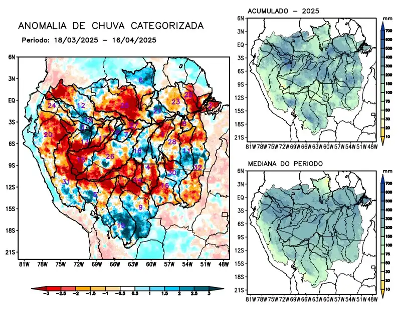
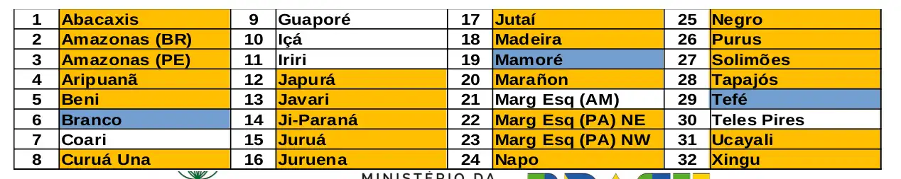
Maps of observed precipitation conditions, individual graphics by basin are produced from MERGE/GPM data generated by INPE/CPTEC, considering the period from de 2000 a 2024. Between March 18 to April 16, 2025, rainfall below climatological levels in the monitored area was characterized by a precipitation deficit on the main course of the Amazon River in Brazilian and Peruvian territory, the hydrographic basins of the Abacaxis, Aripuanã, Beni, Curuá Una, Japurá, Javari, Ji-Paraná, Juruá, Juruena, Jutaí, Madeira, Marañon, the left bank of the Amazon River in the northeast and northwest of the state of Pará, Napo, Negro, Purus, Tapajós, Ucayali, Xingu and the main course of the Solimões River, rainfall above climatology characterized the basins of the Branco, Mamoré and Tefé rivers. Rainfall behavior close to climatology over the Coari, Guaporé, Içá, Iriri river basins, basins on the left bank of the Amazon River in the northeast of the state of Amazonas and Napo. The multi-model forecast indicates a predominance of rainfall below the climatology over the central region, following the main course of the Amazon River from its sources in the Andes to its mouth in the Atlantic Ocean near Marajó Island. Rainfall above the climatology is expected in the extreme south of the region over the basins from the source of the Ucayali, through the Beni, Mamoré, Guaporé, Juruena, upper Teles Pires and Xingu basins in the coming weeks.