Current conditions
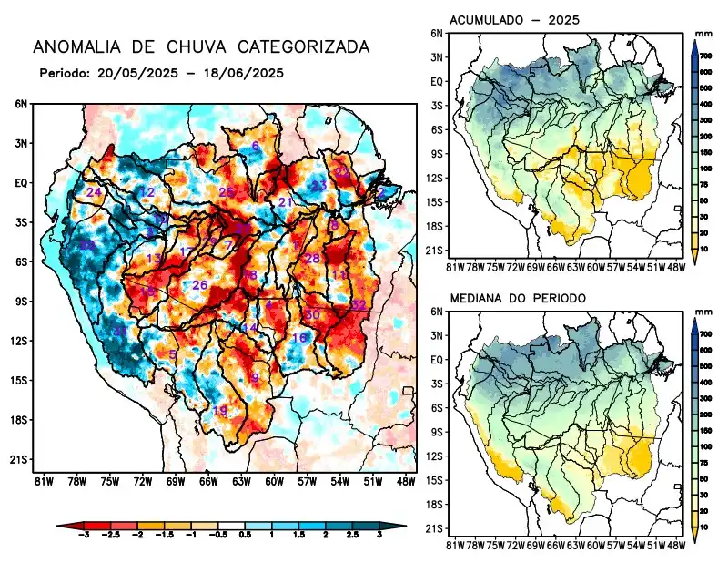
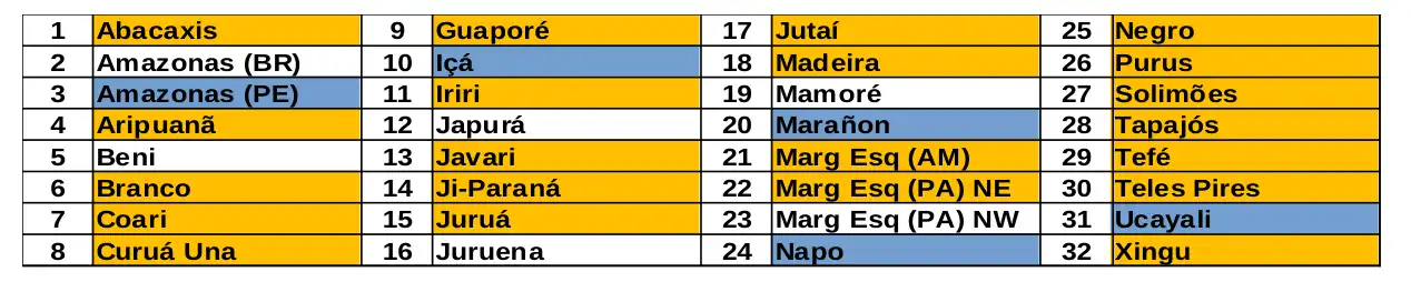
Maps of observed precipitation conditions, individual graphics by basin are produced from MERGE/GPM data generated by INPE/CPTEC, considering the period from de 2000 a 2024. Between May 20 to June 18, 2025, below-average rainfall in the monitored area resulted in precipitation deficits in the river basins of the Abacaxis, Aripuanã, Branco, Coari, Curua Una, Guaporé, Iriri, Javari, Ji-Paraná, Juruá, Jutaí, Madeira, basins on the left bank of the Amazon River in the northeast of the state of Amazonas and northeast of the state of Pará, Negro, Purus, Tapajós, Tefé, Teles Pires, Xingu, and the main course of the Solimões River, rainfall within normal levels on the main course of the Amazon River in Brazilian territory, basins of the Beni, Japurá, Juruena, Mamoré, and basins on the left bank of the Amazon River in the northwest of the state of Pará, rainfall above climatology on the main course of the Amazon River in Peruvian territory, basins of the Içá, Marañon, Napo, and Ucayali rivers. The multimodel indicates for the coming weeks a predominance of rainfall above climatology on the hydrographic basins of the Beni, Coari, Içá, Japurá, Jutaí, Mamoré, Napo, and Tefé, below-normal rainfall over the main course of the Amazon River in Brazilian territory, basins on the left bank of the Amazon River in the northeast of the state of Amazonas and in the northeast and northwest of the state of Pará, and Rio Branco.