A multi-model sub-seasonal forecast CPTEC/INPE-FUNCEME produced on 07/14/2026 for the next 7 and 14 days.
The calibrated sub-seasonal multi-model forecast CPTEC/INPE-FUNCEME is generated through scientific cooperation between CPTEC/INPE and FUNCEME, and comes from a set of 4 global models (a Brazilian model, BAM-1.2/CPTEC, and three US models, CFSv2/NCEP, GEFSv12/NCEP and ESRL/NOAA, the latter three from the SubX project). Brazilian model, BAM-1.2/CPTEC, and three US models, CFSv2/NCEP, GEFSv12/NCEP, and ESRL/NOAA, the latter three from the SubX project). The forecast precipitation anomalies are determined in relation to the climatological period from 1999 to 2016. The outputs for the 7 and 14-day forecast intervals are shown below, detailing the forecast behavior of the basins of interest.
Forecast for the next 7 days
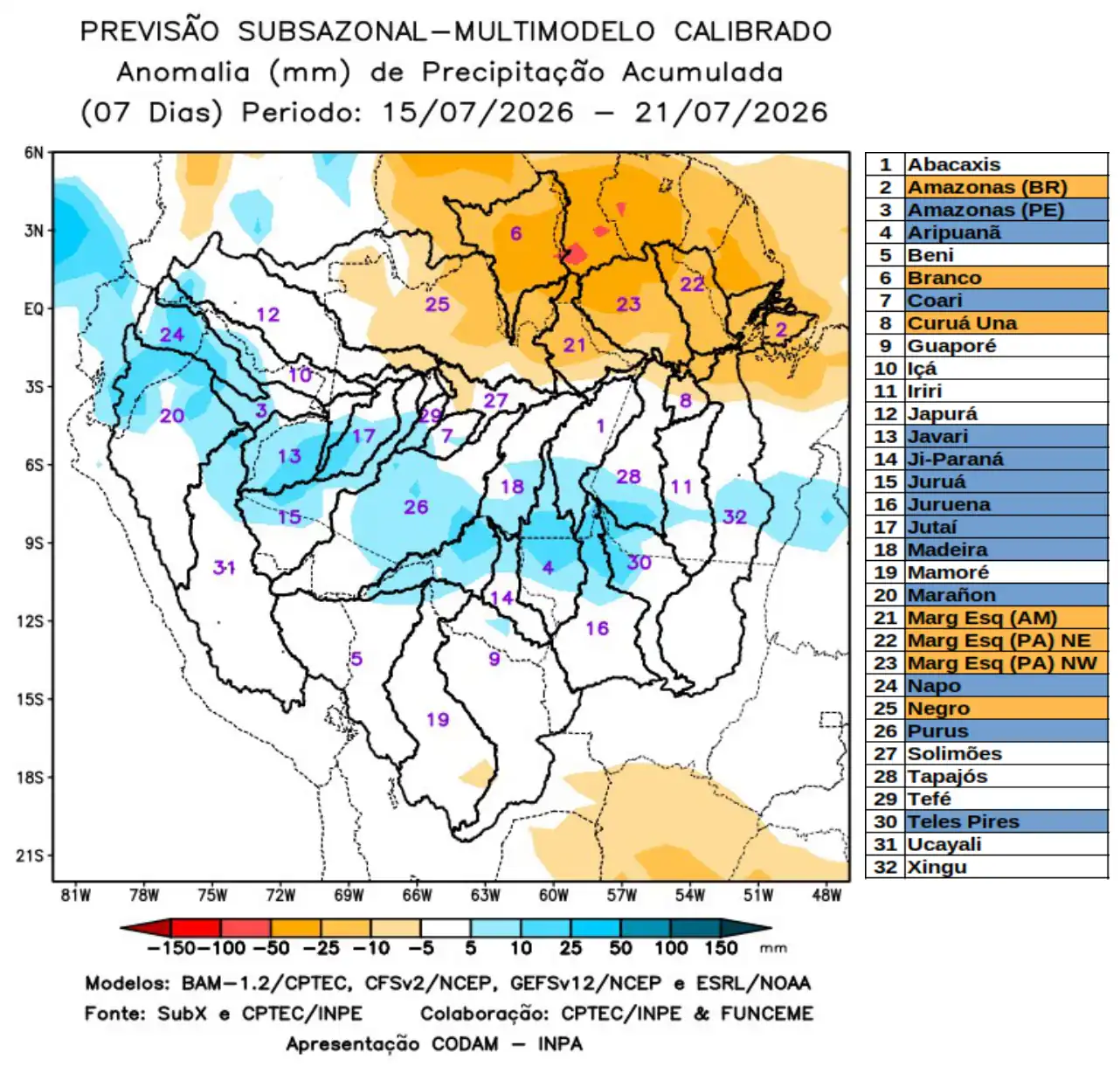
The figure shows the forecast for the 7-day interval between 07/15/2026 and 07/21/2026, forecast of positive precipitation anomalies (blue) in the central part of the monitored region, over the main course of the Amazon River in Peruvian territory, and the watersheds of the Aripuanã, Coari, Javari, Ji-Paraná, Juruá, Juruena, Jutaí, Madeira, Marañon, Napo, Purus, and Teles Pires rivers. Forecast of precipitation deficits (orange) concentrated in the northern part of the monitored area, along the main course of the Amazon River in Brazilian territory, the Branco and Curuá Una river basins, the left-bank basins of the Amazon River in the northeast of the state of Amazonas, the northeast and northwest of the state of Pará, and the Negro River basin. Rainfall close to climatological norms (white) is forecast for the remaining river basins.
Forecast for the next 14 days
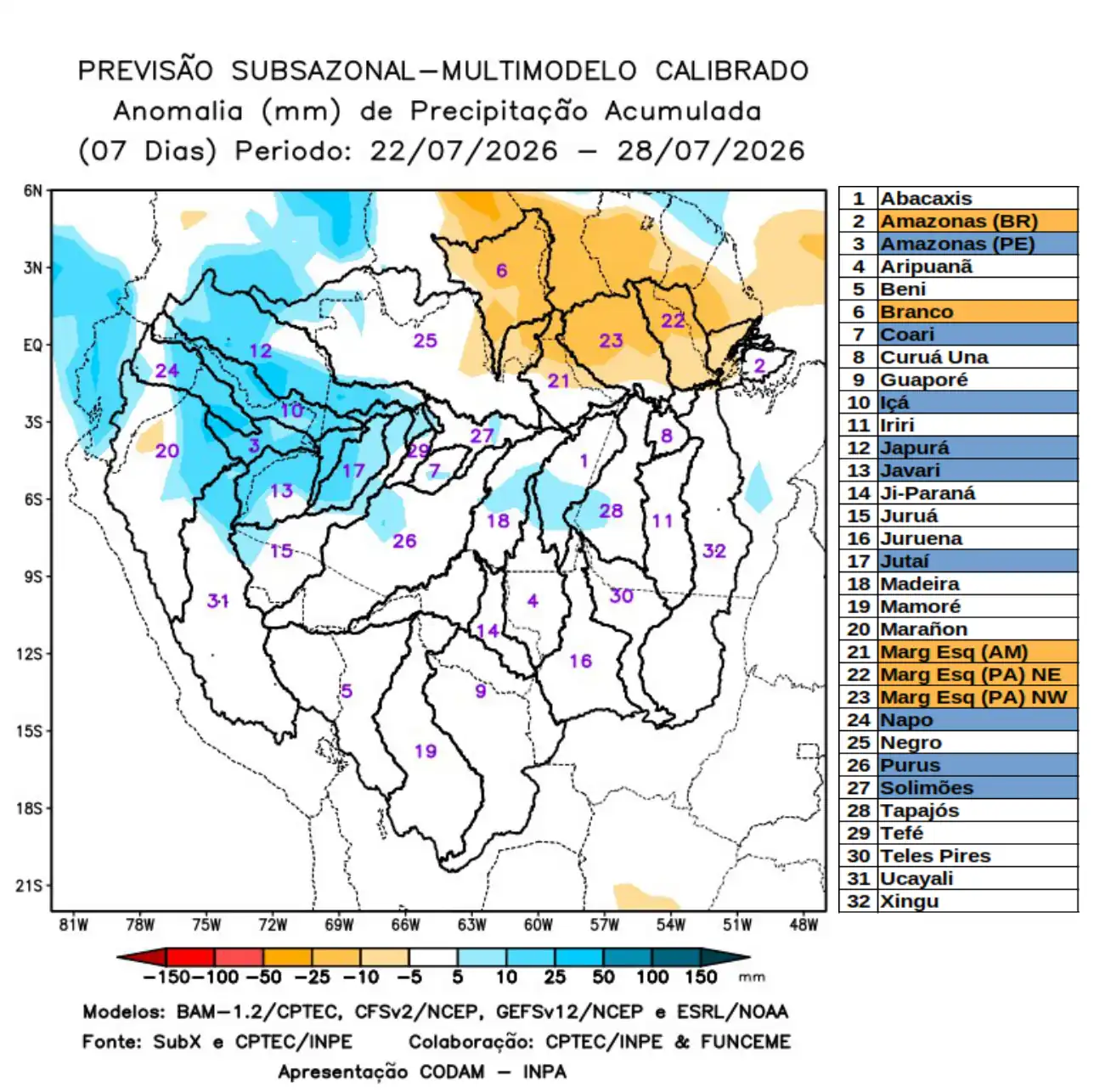
The figure shows the prognosis for the 7-day interval between 07/22/2026 and 07/28/2026, forecast of positive precipitation anomalies (blue) in the northwest of the monitored region, over the main course of the Amazon River in Peruvian territory, the watersheds of the Coari, Içá, Japurá, Javari, Jutaí, Napo, and Purus rivers, and the main course of the Solimões River. Forecast of precipitation deficits (orange) concentrated in the northeast and north of the monitored area, along the main course of the Amazon River in Brazilian territory, the Branco River watershed, and the left- bank basins of the Amazon River in the northeast of the state of Amazonas and the northeast and northwest of the state of Pará. Rainfall close to climatological norms (white) is forecast for the remaining river basins.