Current conditions
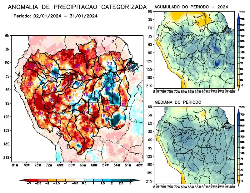
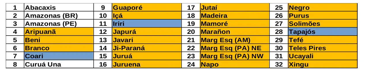
Maps of observed precipitation conditions, individual graphics by basin are produced from MERGE/GPM data generated by INPE/CPTEC, considering the period from de 2000 a 2023. Between 2 de January and January 31, 2024, the rainfall pattern remains below climatological levels in a large part of the monitored area, with rainfall deficits in the basins of the Aripuanã, Beni, Branco, Guaporé, Içá, Japurá, Javari, Ji-Paraná, Juruá, Juruena, Jutaí, Madeira, Mamoré, Marañon, basins on the left bank of the Amazon in the northeast of the state of Amazonas, the northeast and northwest of the state of Pará, Napo, Negro, Purus, Tefé, Teles Pires, Ucayali, Xingu and the main course of the Solimões. The main course of the Amazon River in Brazilian and Peruvian territory and the Curuá Una River basin with observed rainfall close to the climatology for the period, positive rainfall anomalies characterizing the Coari Iriri and Tapajós river basins. The sub-seasonal multi-model forecast indicates rainfall deficits predominating in the east of the monitored area in the coming weeks and excess rainfall over the river basins located over the state of Amazonas and the west of the region, outside Brazilian territory.