Current conditions
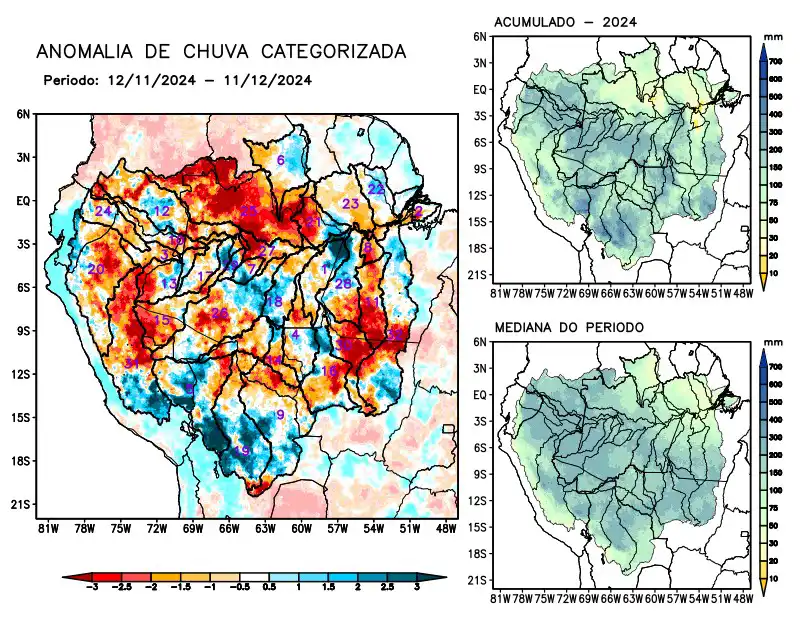
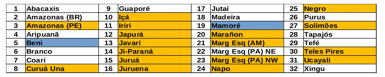
Maps of observed precipitation conditions, individual graphics by basin are produced from MERGE/GPM data generated by INPE/CPTEC, considering the period from de 2000 a 2023. Between November 12 and December 11, 2024, the rainfall pattern remains below climatological levels in a large part of the monitored area, with a precipitation deficit on the main course of the Amazon River in Peruvian territory, the hydrographic basins of the Curuá Una, Içá, Iriri, Japurá, Javari, Ji-Paraná, Juruá, Juruena, Marañon rivers, basins on the left bank of the Amazon River in the northeast of the state of Amazonas and northwest of the state of Pará, Negro, Napo, Negro, Teles Pires, Ucayali and the main course of the Solimões River, rainfall above the climatology characterized the basins located in the southwest of the region, over the Beni and Mamoré river basins. The multi-model forecast indicates normal rainfall over most of the monitored area. Predominantly below-climatological rainfall over the east and west of the monitored area, over the main course of the Amazon River in Basilian and Peruvian territory, the basins of the Aripuanã, Curuá Una, Iriri, Japurá, Ji-Paraná, Juruena rivers, basins on the left bank of the Amazon River in the northeast and northwest of the state of Pará, Negro, Tapajós, Teles Pires and Xingu.