Current conditions
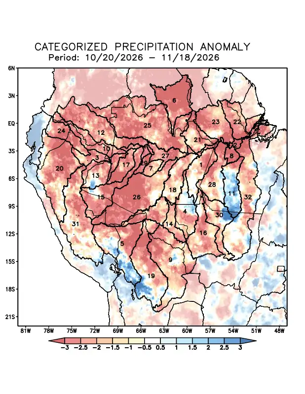
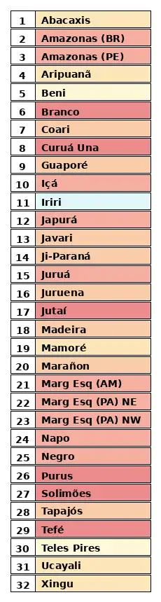
Maps of observed precipitation conditions, individual graphics by basin are produced from MERGE/GPM data generated by INPE/CPTEC, considering the period from de 1998 a 2025. Between October 20 to November 18, 2026, below climatological norms resulted in a precipitation deficit across nearly the entire monitored area, with the greatest intensity observed in the watersheds of the Branco, Curuá Una, Jutaí, Purus, and Tefé rivers, as well as the main course of the Solimões River, where conditions were trending toward extremely dry; Above-normal rainfall was recorded only in the Iriri River watershed and in isolated areas of the middle Aripuanã, upper Beni, and upper Javari watersheds. The multi-model forecast indicates that, for the period from November 11 to 17, 2026, precipitation deficits will predominate across nearly the entire monitored region, with more pronounced deficits over the Beni, Branco, Curuá Una, and Iriri river basins; the basins on the left bank of the Amazon River in the state of Amazonas and in the northwest of the state of Pará; and the Napo and Negro river basins.